
Elk River ZIP Code Coverage
Official city materials identify one ZIP code for Elk River city service. The verified ZIP code is a postal geography, not a compact outline of municipal power. It can guide an address check and help interpret GIS parcel attributes, but it must be read with the site address, parcel identifier, city, county, and service jurisdiction. No additional ZIP should be added to an Elk River ZIP code directory unless an official USPS, city, or state source confirms it for the city.
| ZIP Code | Areas Covered | Post Office | Notes |
|---|---|---|---|
| 55330 | Elk River mailing area and surrounding addresses using Elk River designation | Elk River postal service; verify the exact delivery point with USPS | Official city materials identify it; it is larger than city limits and not a municipal boundary |
City permit requirements state that a valid address or Sherburne PID is required and expressly warn that 55330 covers a larger area than the city limits. A PID, also called a PIN in some county records, is the tax parcel identifier. It is a better bridge between the map, assessor record, and legal description than a ZIP code alone.
Note: Treat the ZIP as a delivery-area fact and confirm city, county, parcel, and service jurisdiction separately for every address.
Why 55330 Exceeds Elk River
ZIP 55330 reaches beyond Elk River's municipal limits. That local mismatch is the key fact behind a careful ZIP code search. An address carrying an Elk River mailing designation can be in an unincorporated or neighboring area, and a community name in a mailing address does not establish municipal jurisdiction. A ZIP result therefore cannot answer which permits, services, boards, taxes, or record custodian apply to the parcel. The city boundary and the postal boundary serve different purposes.
Historic research has a second geography problem. Elk River was platted in 1865, including Orono or Lower Town, and incorporated in 1880. Older sources can use a village, township, plat, or river-side settlement rather than a modern city name. When a historic address does not match a modern label, compare the legal description, old plat, historical map, newspaper wording, and PID where one exists. The official sources reviewed did not identify a citywide readdressing year or a complete postal-boundary map, so neither should be assumed.
Elk River ZIP Code GIS Fields
Sherburne County's parcel services provide the most inspectable ZIP-based record layer. The Sherburne ArcGIS parcel service exposes ZIP and ZIP4 attributes alongside parcel geometry, address parts, ownership and tax-mailing fields, plat fields, acreage, and values. It supports query, statistics, orderBy, distinct, pagination, SQL, and map selection. Its maximum record or selection limit is 2,000, so a broad ZIP query is not a promise of a complete person or parcel roll.
| Exact GIS field | What the documented attribute identifies |
|---|---|
| BLDG_NUM, STREETNAME, STREETTYPE, SUFFIX_DIR, UNIT_INFO | Street, directional, building, and unit components of the parcel address |
| CITY_MAIL, ZIP, ZIP4 | Mailing city and ZIP-related attributes available for query |
| PIN | Parcel identifier linking the mapped feature to tax and property records |
| PLAT_NAME, BLOCK, LOT | Plat and subdivision description fields that help stabilize a parcel |
| OWNER_NAME, OWNER_ADD, OWNER_ADD1, OWNER_ADD2, OWNER_ADD3 | Documented owner and owner-mailing fields |
| TAX_NAME, TAX_ADD, TAX_ADD1, TAX_ADD2, TAX_ADD3 | Documented tax-name and tax-mailing fields |
ZIP and ZIP4 are the exact ZIP attributes documented in the service schema. The layer is parcel geography. It can return a field match for land outside city limits and it does not identify every person at a property. Preserve the PID, situs information, and legal-description fields when a result needs follow-up through the Assessor, city, or Recorder.
The county GIS viewer is pictured below as the map-facing entry point for that parcel layer.

Use the viewer to connect a map location to a parcel record, then check the ZIP or ZIP4 attribute as one part of the address record. Do not use a field match to infer city jurisdiction or a current household.
Confirming an Elk River ZIP Code
USPS is the verification source for a particular delivery address. Use the official address lookup before a GIS query when the question is whether mail service recognizes a location and which ZIP code applies. It is not a substitute for the municipal boundary, parcel line, or city service determination. A non-specific street or intersection can need cross-street information for a city permit inquiry, and commercial sites can have more than one address.
The USPS ZIP Code Lookup is the official address-verification tool.
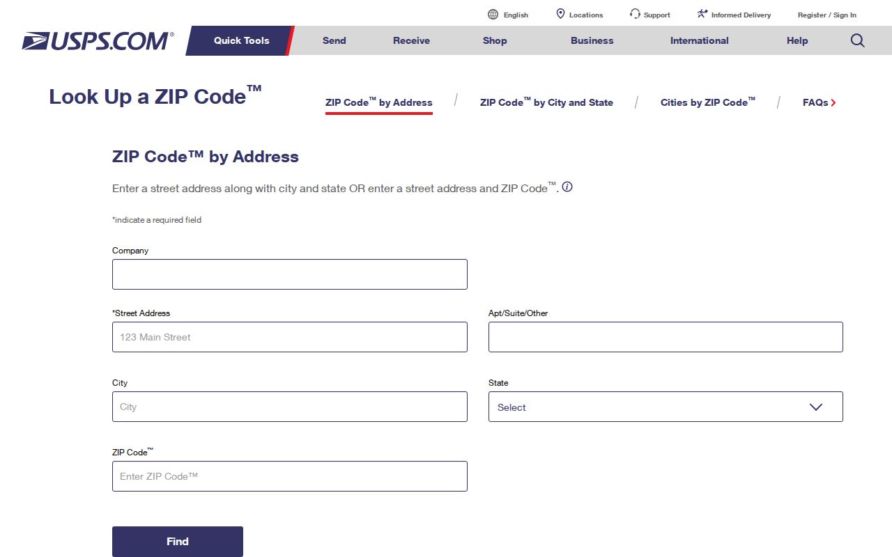
Record the USPS delivery answer with the street address and date checked. Then compare it with Sherburne GIS and the city permit office if a parcel's city status, service area, or jurisdiction remains unclear. USPS verification settles delivery information, not a dispute about land boundaries.
Elk River ZIP Code Workflow
A ZIP code directory narrows a place, not a person. The practical record chain begins with a delivery address and ends with a parcel or custodian record. Sherburne GIS can query the ZIP and ZIP4 fields. The voter public-list process uses City/Town or Ward/Precinct geography, not an unrestricted ZIP-wide public search. Recorder records are organized around legal and document information, not a ZIP-wide deed search. That means a ZIP alone is never enough for a reliable resident-related question.
- Check the exact delivery address in USPS ZIP Code Lookup and retain the returned ZIP with the date of the check.
- Query the parcel service by the documented ZIP or ZIP4 attribute, then capture the PIN, street components, CITY_MAIL field, and legal-description fields.
- Compare the parcel location with the city jurisdiction and, when permits are relevant, provide the city with the address or Sherburne PID.
- Use the specific record custodian for the next question: Elections for a lawful voter request, Assessor for property data, Recorder for documents, or the city for permit applications.
Once an address is narrowed to a particular street and parcel, the Elk River street directory has the separate address-by-address record path. It is better suited to parcel, deed, and street context than a ZIP-based search.
Note: No county ZIP-specific voter-registration statistics were located in the official materials reviewed for Elk River.
Parcel Context for Elk River ZIP Codes
The Sherburne County Beacon property search is the assessor-side complement to GIS. County documentation confirms that basic access can provide address, classification, estimated market and assessed value, homestead, legal description, PID, school district, section-township-range, and tax information. Fee-based CAMA access can add pictures, comparables, current owner, building and interior details, recent sales, style, and year built. An owner of record is not every resident at the address.

The live Beacon page was not available for field inspection, so an advanced ZIP filter, exact field labels, sorting, pagination, and export behavior were not verified. Do not assume that an assessor ZIP search exists simply because GIS exposes ZIP and ZIP4. Use Beacon to corroborate a known parcel or address, and contact the Assessor when a field or jurisdiction question needs confirmation.
City Building Safety materials add a useful guardrail: an application needs an address or PID, along with project information such as valuation, description of work, plans, or a site plan. The reviewed sources did not reveal a public permit-result database. A permit application can establish a project or applicant connection, but not residence.
Why Recorder Searches Skip ZIP Codes
Recorded deeds, mortgages, liens, plats, and Torrens records have a different key structure. The Sherburne County Recorder's RecordEASE portal is tied to land-record indexes and documents, not a public ZIP-wide deed filter. A reliable Recorder search begins with the legal description, grantor or grantee name, or document number obtained from a parcel record. The abstract index reaches from 1957, while abstract images reach from 1851; Torrens index and images reach from 1910. Those coverage dates do not create a ZIP search option.
Online RecordEASE access is payment and login gated. The Recorder counter is a fallback, and the document data-request form can request a copy by known document number. The office does not look up missing document numbers on that form. Start with the PID and legal description, rather than sending a broad request for all deeds in a ZIP area. The same restraint prevents a postal area from being mistaken for a single property history.
Elk River ZIP Code Limits
ZIP boundaries and city limits are not interchangeable. Parcel records can contain a ZIP, but their strongest uses are linking a mapped polygon to a PIN, situs address, legal description, and tax context. A voter public-list request has statutory geography and purpose limits. A Recorder search follows the land document, not the postal service. Keep those systems separate, and ask the relevant office when a city service, address, or map boundary is disputed. That approach prevents a ZIP code directory from making a claim that its source cannot support.
- ZIP versus ZIP+4
- A ZIP is the broad USPS delivery code; ZIP+4 adds a more specific delivery segment and is an attribute in the county GIS service.
- PO-box ZIP
- A ZIP used for post-office-box delivery rather than as proof of a street delivery area or city jurisdiction.
- Unique ZIP
- A ZIP assigned to a single organization or large receiving location; none was verified for Elk River in the reviewed official sources.
- Carrier route
- A USPS delivery-route grouping. It is useful for mail handling, but it is not a city-limit or parcel-boundary record.
The safe way to report an address result is simple: name the ZIP, identify the parcel or delivery source, state the city and county jurisdiction separately, and record the date. Where the evidence stops, ask Sherburne GIS, the Assessor, or the city permit office rather than filling the gap with an assumption.